Showing posts sorted by date for query "Route 66". Sort by relevance Show all posts

August 24, 2018

Amarillo, Texas: Route 66 Historic District; things to do

Amarillo is the mid-point of The Mother Road (so named by John Steinbeck in “The Grapes of Wrath”)--the famous 2,448-mile road known as Route 66 that runs between Santa Monica and Chicago, crosses eight states, and passes through three time zones.  It is also the largest Texas city on the route.  Here, Route 66 is now Amarillo Boulevard.  Do take time to get off the ol’ super-slab interstate freeway and check it out.

Route 66 Historic District in Amarillo, Texas


The U.S. Route 66 Historic District here is a mile-long stretch of the road that features clubs, shops, and restaurants.  Favorites include the Nat Ballroom, which is presently an antique store, and the Golden Light Café, where you can get a good hamburger.  Only three neon signs are left, and none work.  The extended route along Amarillo Boulevard is almost all mom and pop motels now, along with plenty of good Thai restaurants (but also a few working girls and crack houses), and more than 40 languages are spoken along the route. 

It is claimed that more people have recorded “Get Your Kicks on Route 66” than any other song.


Stops Along Route 66

2719 SW 6th Ave. (Old Route 66), (806) 664-3089.  

The Life Art Gallery displays the work of local artists as well as owner Bob “Crocodile” Lile’s exclusive line of cadilite jewelry made from the paint layers that peel off the town’s famous Cadillacs.  A lovely Australian Shepard, Lady, keeps watch at the door.  Lady likes to greet people and is especially fond of little girls.

Bob "Crocodile" Lile and dog Lady in doorway of Lile Art Gallery on Route 66 Historic District in Amarillo, Texas
Bob "Crocodile" Lile and dog Lady in doorway of Lile Art Gallery
on Route 66 Historic District in Amarillo, Texas


Bob "Crocodile" Lile's work table at Lile Art Gallery on Route 66 Historic District in Amarillo, Texas
Bob "Crocodile" Lile's work table at Lile Art Gallery
on Route 66 Historic District in Amarillo, Texas


cadilite jewelry at Lile Art Gallery on Route 66 Historic District in Amarillo, Texas
cadilite jewelry at Lile Art Gallery on Route 66 Historic District
in Amarillo, Texas


●Vega

          ●Magnolia Station  

201 S. Main St.  Free.  This old-time gas station (known as a filling station in the good old days)--was restored by the city.

historic Magnolia Station on Route 66 Historic District in Vega, Texas
historic Magnolia Station on Route 66 Historic District
in Vega, Texas


          ●Milburn-Price Culture Museum  

1005 Coke St.  Free.  Learn area history and view some interesting artifacts, including an original 1923 model T “Lizzy” parked out front.

longhorn statue outside Milburn-Price Culture Museum on Route 66 Historic District in Vega, Texas
longhorn statue outside Milburn-Price Culture Museum
on Route 66 Historic District in Vega, Texas


          ●Oldham County Courthouse  

This classic revival building dates to 1915.  The original hipped roof was removed in 1967.


●MidPoint Cafe and Gift Shop  

305 W. Historic Route 66, in Adrian, (806) 538-6379.  Daily 8:30am-5pm.  

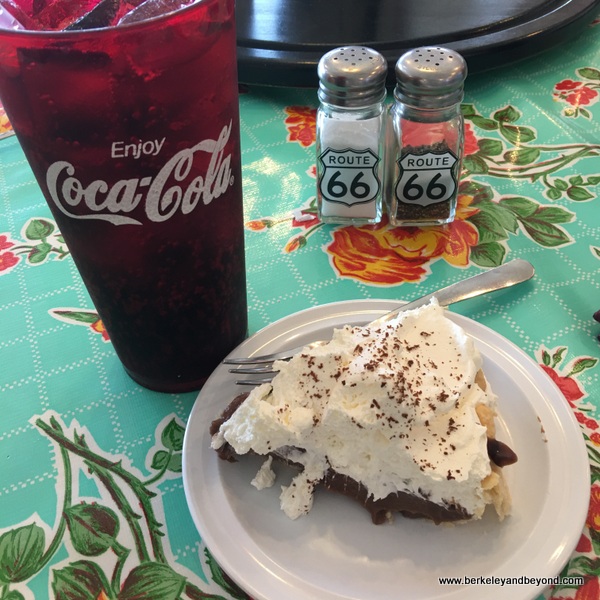
Located at the exact midpoint of the Route 66 journey, this cafe measures 1,139 miles to starting points in L.A. and Chicago and makes the perfect stop for refreshment.  Because the pies are made fresh daily on site, they are really good--I had a chocolate cream that was divine.  Patrons can help themselves to a coke from the fridge and pay at the counter.  Comfy booths and a swivel-stool counter are among the seating options.  And the gift shop is loaded with souvenir items that you might actually want.

midpoint photo op on Route 66 Historic District in Adrian, Texas
midpoint photo op on Route 66 Historic District
in Adrian, Texas


sign in front of MidPoint Cafe on Route 66 Historic District in Adrian, Texas
sign in front of MidPoint Cafe on Route 66 Historic District
in Adrian, Texas


interior of MidPoint Cafe on Route 66 Historic District in Adrian, Texas
interior of MidPoint Cafe on Route 66 Historic District
in Adrian, Texas


chocolate cream pie at MidPoint Cafe on Route 66 Historic District in Adrian, Texas
chocolate cream pie at MidPoint Cafe
on Route 66 Historic District in Adrian, Texas


●Triangle Motel  

7954 Amarillo Blvd. East.  

This motel was constructed of hand-cut bricks in 1945.  Before it closed in 1970, the center court once held a nice garden, picnic tables, and a children’s playground.  Now it is just a dusty mess waiting for the new owners--Alan McNeil & his Mom Maryann McNeil--to bring it back to life.

exterior of old Triangle Motel on Route 66 Historic District in Amarillo, Texas
exterior of old Triangle Motel on Route 66 Historic District
in Amarillo, Texas


More things to do in Amarillo.

More ideas for exploring the U.S.


images ©2018 Carole Terwilliger Meyers 

August 8, 2018

Amarillo Texas: Cadillac Ranch; things to do

West of town, on old Route 66, south of I-40 between exits 60 and 62. 

The Cadillac Ranch is one of the most famous art installations in the United States.

overview of Cadillac Ranch in Amarillo, Texas


Cadillac Ranch was created along the iconic Route 66 in 1974 by Stanley Marsh 3 in collaboration with Chip Lord, Hudson Marquez, and Doug Michels--who were a part of the Ant Farm art group in San Francisco.  A tribute to the Golden Age of American automobiles, it consists of ten Cadillacs (1948 to 1963 models) that are nose-dived bottoms up into the ground and partially buried.  It reminds me of the moai statues on Easter Island.  Because it is so dramatic, this installation has been featured in a variety of music videos and movies, including “Rockin' the Caddy at Cadillac Ranch, TX.”  The installation was moved in 1997 from its original cow pasture location, but is still out in a cow pasture.  People park their cars along the road and walk in.

entrance to Cadillac Ranch in Amarillo, Texas


dirt road leading to Cadillac Ranch in Amarillo, Texas


Over the years, visitors started adding their own flair to the buried cars with spray paint.  This can be a problem when the wind is blowing, because you and your clothing can also wind up more colorful.  If you’re going to indulge, bring plastic gloves and maybe even a plastic rain cover or garbage bag to protect your clothing.  I wound up getting nauseous from the paint can fumes, so it isn’t a bad idea to also bring along a respirator mask to protect you from the aerosol fumes--it also winds up making you look like you are a serious graffiti artist.  At least one guy in town collects the peeling paint and turns it into souvenir jewelry.

overview of Cadillac Ranch in Amarillo, Texas


visitor taking a picture at Cadillac Ranch in Amarillo, Texas


visitor working with spray can at Cadillac Ranch in Amarillo, Texas


visitor working with spray can at Cadillac Ranch in Amarillo, Texas


visitor taking a selfie at Cadillac Ranch in Amarillo, Texas


More things to do in Amarillo.

Great ideas for travel adventures in California and the U.S. and around the world.

images ©2018 Carole Terwilliger Meyers 

April 30, 2018

Nassau, Bahamas: Fort Fincastle and Queen's Staircase; things to do

Bennet's Hill 

It is easiest to start at the top of Bennet's Hill--at the fort--and then walk one block downhill to the staircase.

●Fort Fincastle  

At top of the hill.  Daily 8am-4pm.  $3, $2 kids (don’t need to tip guide if payment is taken, otherwise $1 tip).  

Shaped like a paddle-steamer, Fort Fincastle was built circa 1793.  It overlooks Nassau and Paradise Island and the eastern approach to New Providence.  Cannons here include two 24 pounders, two 32 pounders, two 12 pounders, and one howitzer.  The fort served as a lighthouse until 1817, when it was replaced by the lighthouse on Hog Island (now Paradise Island).  It then became a signal station.

Fort Fincastle in Nassau, Bahamas


entrance to Fort Fincastle in Nassau, Bahamas


●The Water Tower  

Behind Fort Fincastle.  

The Water Tower was erected in 1928 to maintain water pressure on the island.  At 126 feet, it is the tallest structure on the island and provides a marvelous panoramic view of town.  It has a narrow, winding staircase with 216 steps, however currently the tower is closed and there is no public access.  Eventually it will reopen as part of the fort.

The Water Tower, behind Fort Fincastle in Nassau, Bahamas


●Souvenir vendors 

line the street leading down from the fort to the Queen’s Staircase.

souvenir stands by Fort Fincastle in Nassau, Bahamas


●Queen's Staircase  

Elizabeth Ave. South.  Free.  

Commonly referred to as “the 66 steps,” this major landmark was carved out of solid limestone rock by slaves between 1793 and 1794.  It provided a direct route from Fort Fincastle to downtown.  The steps were later named in honor of Queen Victoria, who reigned in Britain for 64 years from 1837 to 1901.  Because the pathway that leads to the steps was paved and the bottom step is buried under the asphalt, only 65 steps are visible.  Today, its cool limestone walls, waterfall, and foliage make it feel like an oasis.

top of Queen's Staircase in Nassau, Bahamas


waterfall at Queen's Staircase in Nassau, Bahamas


bottom of Queen's Staircase in Nassau, Bahamas


images ©2018 Carole Terwilliger Meyers 

January 16, 2018

Santa Monica, California: Santa Monica Pier; things to do

Santa Monica Pier  

At end of Colorado Blvd./Ocean Ave., (310) 260-8744.  Free access. 
 
Dating from 1909, this wooden wharf, now known as a “pleasure pier,” holds a variety of restaurants and attractions.  A wide, paved footpath leading onto the Santa Monica Pier extends west from Ocean Ave.  The pier juts out over beautiful Santa Monica State Beach and on over the ocean and is lined with attractions, restaurants, and shops. 

●pier map

entrance to Santa Monica Pier in Santa Monica, California


overview of Santa Monica Pier in Santa Monica, California


●Free Historical Walking Tours are scheduled on Saturday and Sunday at 11am and noon.  They last an hour and depart from the Pier Shop in the carousel building. 

●Webcam:  View the action before and after you visit.

●Parking: 
     ●A parking lot is adjacent down on the beach.  $6-$15.
     ●An inexpensive city parking lot, Garage 8, is at 4th St./Colorado Ave..  First 90 minutes are free, then $1.25/hour. 
     ●map 

oceanfront parking lot at Santa Monica Pier in Santa Monica, California

●At the start of the pier is an antique 1922 Philadelphia Toboggan Company carousel with its original Wurlitzer organ plus 740 lights, 2 hand-carved chariots, and 44 original hand-painted hand-carved wooden horses--not to mention a pig and ram.  It is completely enclosed in a 1916 Looff Hippodrome building, making it the perfect rainy day destination as well.  Parts of “The Sting” with Paul Newman were filmed here.  $2, children $1.

antique carousel at Santa Monica Pier in Santa Monica, California

Santa Monica Pier Aquarium

●On the level below the carousel, the Santa Monica Pier Aquarium exhibits more than 100 local marine animals and plants (my favorite are the moray eels in the tall Kelp Forest tank).  Run by nonprofit Heal the Bay, it offers three touch tanks where kids can handle sea stars, sea cucumbers, urchins, hermit crabs, and several kinds of sea snails, plus a popular shark nursery where newborn pups are on display and egg cases can be viewed.  Educational activities and special events such as Sea Star Feeding on Tuesdays and Fridays at 2:30 p.m. and Storytime Saturdays at 2 p.m. are also scheduled.  The Aquarium is a part of Santa Monica’s own “Heal the Bay” program, an initiative to educate, inspire, and empower its visitors to be stewards of the environment.  Tu-F 2-5pm, Sat-Sun 12-5pm; in summer to 6pm.  $5, children under 13 with paying adult are free.

moray eel at Santa Monica Pier Aquarium at Santa Monica Pier in Santa Monica, California
moray eel at Santa Monica Pier Aquarium at Santa Monica Pier
in Santa Monica, California


●The Trapeze School of New York 

offers a fun-filled experience for everyone.  Classes are 2 hours long, and no prior experience is necessary.

trapeze school at Santa Monica Pier in Santa Monica, California


●66 To Cali 

sells American-made souvenirs near the spot where the iconic Route 66 ends at the ocean.  Nearby is an official sign indicating you’re at the end of the road--the perfect spot to capture a photo--but the actual end of the route is a little farther away at the intersection of Lincoln Boulevard and Olympic Boulevard on Highway 101. 

tour group from Wenzhou, China at the Route 66 sign on the Santa Monica Pier in Santa Monica, California
tour group from Wenzhou, China at the Route 66 sign on the Santa Monica Pier
in Santa Monica, California


●The Playland Arcade 

has more than 200 games from the classic to the contemporary. 

●Pacific Park--

the West Coast’s only amusement park on an oceanfront pier--has a variety of rides, including the 9-story-high solar-powered Pacific Wheel Ferris wheel (the largest on the West Coast and the world’s first solar-powered) and a unique 5-story-high column-suspended roller coaster.  An assortment of midway games round out the fun.  Daily in summer.  Rides $5-$10; wristbands age 8+ $32.95, online $29.65, 7 &under $17.95, online $16.15.

solar-powered Ferris wheel on the Santa Monica Pier in Santa Monica, California
solar-powered Ferris wheel on the Santa Monica Pier
in Santa Monica, California


●You can fish off the pier.  No license is required, and Pier Bait and Tackle offers gear, poles, and bait. 

●The pier has 7 restaurants, ranging from fine seafood to classic American.  Among them, The Lobster has been a favorite with locals since 1923 and features traditional American seafood and whole lobsters plus ocean views.  Bubba Gump appears mid-pier, and the Food Court is in Pac Park. 

●war memorial:  

Each Sunday from sunrise to sunset, a temporary memorial of crosses appears in the sand below the pier.

war memorial in the sand beside the Santa Monica Pier in Santa Monica, California
war memorial in the sand beside the Santa Monica Pier
in Santa Monica, California


●The Original Muscle Beach 

is along the Ocean Front Walk about a block south of the pier.  There await muscle-building equipment, volleyball courts, and a children’s playground featuring a stone-walled sandbox with a concrete Viking ship and an interactive dragon’s head.


More things to do in Santa Monica.


images ©2017 Carole Terwilliger Meyers 

November 6, 2015

Oatman, Arizona: Let's visit the donkeys; things to do

Let's visit the donkeys in Oatman, Arizona

Situated at elevation 2,700 feet and on the 38th parallel, the old Gold Rush town of Oatman in Arizona is on the original, now defunct, Route 66.  Started in 1906 as a tent camp, its mines had produced 1.8 million ounces (worth about $60 million) of gold by 1931.  The boom was over by the mid-1930s, and in 1942 the few remaining mines closed after being declared nonessential to the war effort. 

sign for Sidewalk Egg Fry in Gold Rush town of Oatman, Arizona


Now this historic mining town is a sort of "living ghost town," with about 100 permanent residents.  A mine shaft opening can be entered at no cost, and shootouts on main street are scheduled daily.

mine shaft in Gold Rush town of Oatman, Arizona


shootout in front of Oatman Hotel in Gold Rush town of Oatman, Arizona


But most people come here to see the burros, which are also known as small donkeys.  
 
adult burro in Gold Rush town of Oatman, Arizona


Though it is wise to keep a safe distance from them because they are wild and will sometimes bite and kick, that is almost impossible to do.  Especially the babies, which are too, too cute and just beg to be petted.  You can buy inexpensive feed for the adult burros—just watch that they don’t come after you for more and take a nip out of your shirt or purse by mistake—but you’re reminded by a note attached to their foreheads not to feed the babies.  They are still nursing and regular food is detrimental to their health.

baby burro with do not feed note on forehead in Gold Rush town of Oatman, Arizona
baby burro with do not feed note on forehead
in Gold Rush town of Oatman, Arizona


Burros were brought to the area by early prospectors. They were used inside mines for hauling rock and ore, and outside for hauling water and supplies.  Eventually, when the mines closed, they were released into the surrounding hills.


Oatman Hotel  

181 Main St., (928) 768-4408.  Hollywood movie stars Clark Gable and Carole Lombard famously honeymooned here at the Oatman Hotel in 1939.  You can view their upstairs honeymoon suite for a small fee.  The hotel dates back to 1902.  It survived a bad fire in 1920 and is now the oldest two-story building in Arizona's Mohave County and is on the Registrar of National Historic Places. The hotel looks pretty much like it did when the miners were here and is rumored to be haunted by Oatie the ghost.  Downstairs is a bar and cafe that are memorable for the dollar bills tacked like three-dimensional wallpaper to the wall, a tradition that started with the miners back when 5 cents bought a beer.  They would write their name on a dollar bill and tack it to the wall to start a tab.  Ask to borrow a staple gun and add your own signed dollar.  The menu is simple American food.  But the $6 cocktail menu offers temptingly named drinks:  Oatman Punch, Blushing Burro, Pink Lizard, Snake Bite, and Donkey Pee, which is made with Parrot Bay coconut rum, sour mix, and club soda, and many swear is quite tasty. 

restaurant at Oatman Hotel in Gold Rush town of Oatman, Arizona


Oatman, Arizona, is 28 miles southeast of Laughlin, Nevada.  Getting there takes you along Route 66 through the scenic Black Mountains.  They are dotted with cholla plants and tumbleweeds, some of which bear the wind-blown remnants of decorations bestowed upon them by schoolchildren at Christmases past. 


More information about Oatman, Arizona.

Things to do in nearby Las Vegas, Nevada.

More ideas for exploring the U.S.

 
images ©2015 Carole Terwilliger Meyers 


August 23, 2013

Spend the night on an Indian reservation in Acoma, New Mexico

Spend the night on an Indian reservation in Acoma, New Mexico


Stop midway between Albuquerque and Flagstaff on Highway I-40 (which replaced the famous Route 66) to explore the wide open spaces of the vast Acoma Indian Reservation and perhaps do a little gambling.  It is jeans-and-t-shirt casual.  Read more. . . 

a lonely road on the vast Acoma Indian Reservation in Acoma, New Mexico


More things to do in New Mexico.


article and image c2013 Carole Terwilliger Meyers

Popular Posts